Home /
Expert Answers /
Statistics and Probability /
the-data-in-the-accompanying-table-represent-the-land-area-and-highest-elevation-for-each-of-seven-pa657
(Solved): The data in the accompanying table represent the land area and highest elevation for each of seven ...
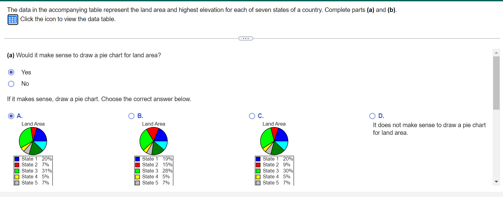
The data in the accompanying table represent the land area and highest elevation for each of seven states of a country. Complete parts (a) and (b). Click the icon to view the data table. (a) Would it make sense to draw a pie chart for land area? Yes No If it makes sense, draw a pie chart. Choose the correct answer below. A. B. C. D. I and Aroa I and Area I and Aroa It does not make sense to draw a pie chart for land area.
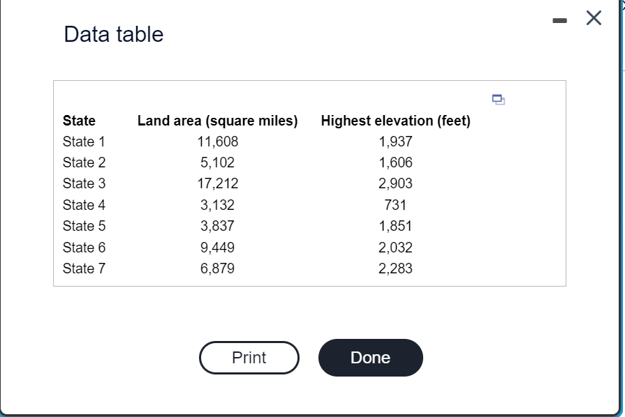
Data table
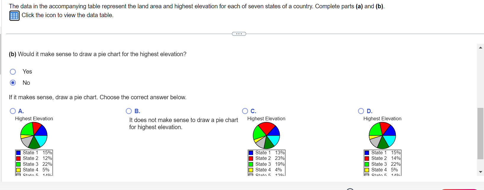
The data in the accompanying table represent the land area and highest elevation for each of seven states of a country. Complete parts (a) and (b). Click the icon to view the data table. (b) Would it make sense to draw a pie chart for the highest elevation? Yes No If it makes sense, draw a pie chart. Choose the correct answer below.