Home /
Expert Answers /
Earth Sciences /
figure-1-the-bathymetry-of-bedford-basin-the-sackville-river-flows-in-through-the-north-near-1-7-pa150
(Solved): Figure 1: The bathymetry of Bedford Basin. The Sackville River flows in through the north (near (1,7 ...
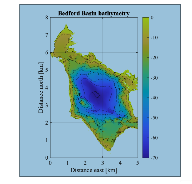
Figure 1: The bathymetry of Bedford Basin. The Sackville River flows in through the north (near (1,7.5)). The Narrows in the south-east corner (5,2), connect the basin to Halifax Harbour, and eventually to the ocean. a) The depth mean density of water in Bedford Basin is maximal in the spring, with a value of 1024.563 kg m?3, and minimal in the fall, with a value of 1024.213 kg m?3. By approximating the shape of Bedford Basin as a half ellipse and assuming no net changes in volume between the seasons, estimate the total mass 1 of water in the basin in each season. The basin has a maximum depth of 70 m, length of 8 km and width of 5 km. b) The Sackville River flows into the head of the basin with a volume transport of around 5 m3s?1. Assuming the volume of water in the basin is constant in time, use the bathymetry showed in Figure 1 to estimate what must be the speed of the mean current leaving the Narrows?